How can we transform a world of data into a world of actionable information to address environmental issues?
At the Sabin Center, our Faculty Affiliates and Fellows are pushing the boundaries in the generation and application of artificial intelligence and computational sustainability to our most pressing environmental problems.
We are living in an era where the scale, complexity, and speed of data generation about the world around us presents virtually infinite information, thanks to ever-evolving technologies including modern satellites providing 24/7 monitoring of our earth, drones surveying vast and largely inaccessible areas, and other forms of remote sensing. Traditional methods of analyzing environmental data are insufficient to meaningfully process it, let alone develop actionable insights for decision-makers.
AI Innovation in Remote Sensing and Conservation
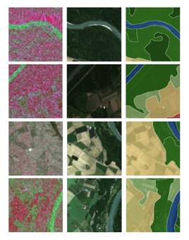
The AI Innovation in Remote Sensing and Conservation Group (AIRSC) brings together faculty from Computer Sciences, Engineering, and Biology to advance work on critical issues including protected area management, human-wildlife conflict, and environmental degradation. The AIRSC explores novel methods and applications for computational technology in the fields of conservation and ecology, including accurate satellite and drone image segmentation, data fusion, high performance computing solutions, and software development. Their insights have been used to measure the impact of increasing alluvial mining in tropical river sediments, develop more accurate methods of palm forest measurement, and more.
Supporting Indigenous Stewardship:
Connecting Cultures
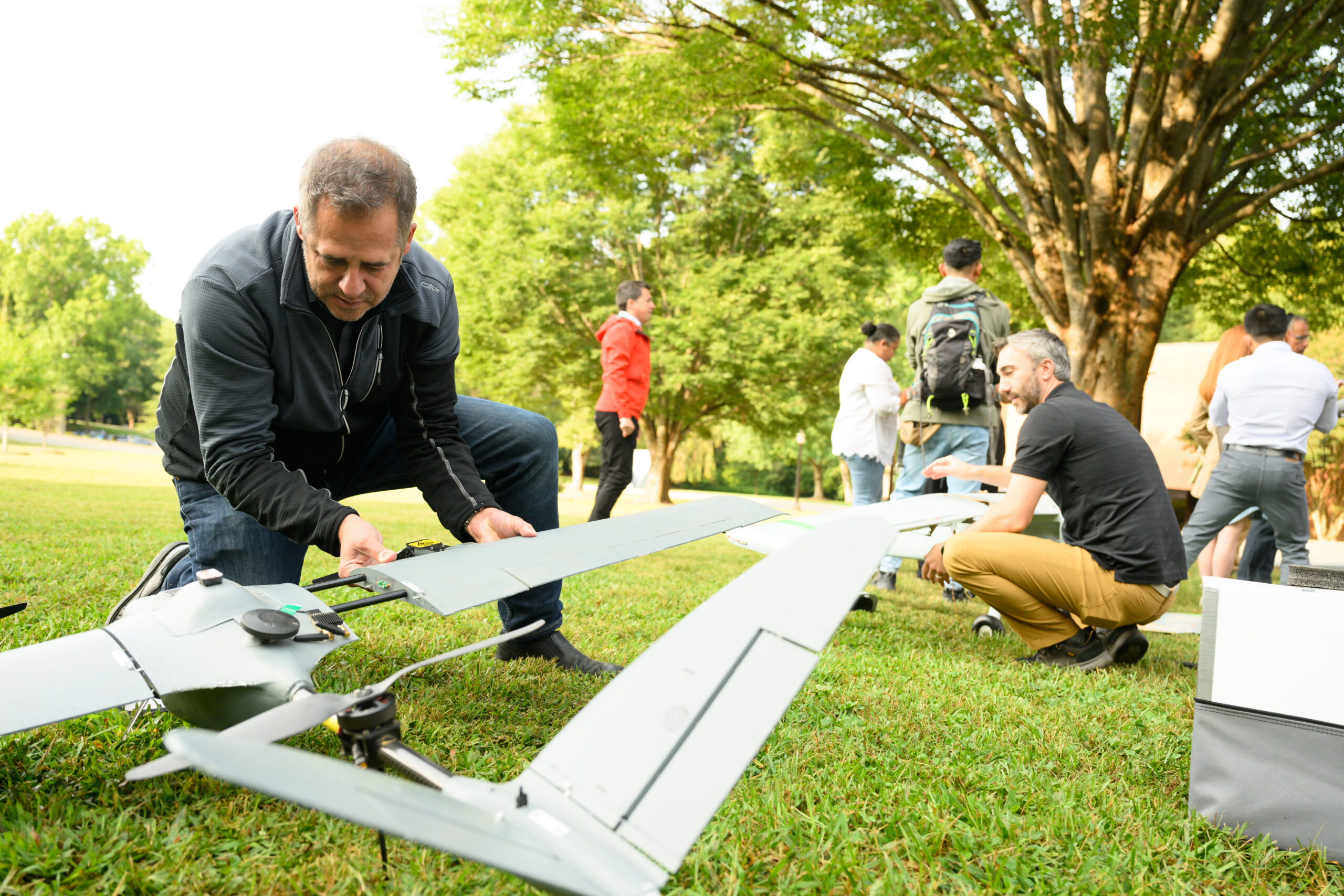
The AIRSC’s work has been instrumental in advancing our understanding of Artisanal and Small-scale Gold Mining (ASGM) in the Peruvian Amazon, helping not only to more accurately quantify the nature and scale of its environmental impact, but also to predict where new mining activity is likely to occur. And to ensure this technology is put to use by environmental stewards on the front lines, our Connecting Cultures delegation of young Indigenous leaders receive training on drone usage for monitoring and protecting their territories in the Amazon. Hear more about their experience as reported by WFDD Public Radio.
Environmental
Dynamics Lab
Led by Sabin Center Board Member Lauren Lowman, the Environmental Dynamics Lab explores how spatial and temporal changes in water availability impact overall ecosystem health, productivity, and sustainability. The Lab’s analysis incorporates engineering, physics, biology, chemistry, hydrology, and ecology, employing Computational Modeling, Geospatial Analysis, and Field Experiments featuring both ground-based and aerial measurements to further their understanding. The Lab is currently studying the interplay between fire conditions and ecosystem health in the Southeast.
Lowman on Weather Whiplash & Wildfires
Wondering why we’ve seen so many wildfires in the Southeast in recent years? Sabin Center Board Member Lauren Lowman has answers. Learn more about the critical role wildfire plays in our regional ecosystems, and how extreme weather swings between flash droughts and hurricanes – yes, even in the mountains of the Western Carolinas – can amplify wildfire intensity in her explainer video, or dig deeper with her article in The Conversation.
The Di Vittorio Lab
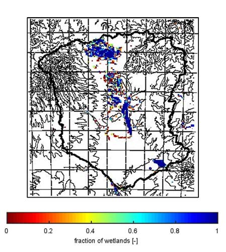
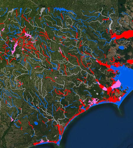
Led by Faculty Affiliate Courtney Di Vittorio, The Di Vittorio Lab develops satellite-based data products, hydrologic modeling, and decision support tools, studying areas from the American Southeast to the Sudd wetlands. Dr. Di Vittorio and her team are currently developing satellite-based water quality algorithms for High Rock Lake, North Carolina, augmenting more expensive in-situ water collection with satellite-based estimates of water quality for more comprehensive and data-driven water quality improvement plans.
Di Vittorio Highlights Community Partnerships to Advance Cleaner Water
At our November 2025 Sustainable, Just, and Abundantly Wild conference, Dr. Vittorio joined Ph.D. candidate Jaime Cardenas and Sabin Center Interim Executive Director Scott Schang to highlight the partnership between Wake Engineering and Yadkin Riverkeeper to address water quality issues in North Carolina and beyond, including with the satellite-based water quality algorithms being developed at the Di Vittorio Lab.